VIR Tracks
For VIR Fuel see separate documentation
VIR Tracks:
This application allows for the cross-checking Oceanic Clearance waypoint data against route waypoints inserted into a Flight Management Computer.
By compiling a sequence of waypoints, reflecting a changed Oceanic Clearance, the app will generate track and distance information which can be compared with the revised route information that is inserted into the FMC legs page. In this way a waypoint insertion error will become apparent if the cross-check shows a discrepancy. Revised timing information can be generated by providing groundspeed data and there exists the feature to compare distance-to-go mileage at original waypoints (from the fuel plan) against the new track in order to define a valid fuel fix defined by track distance to the next available original planned waypoint.
Step 1: add new waypoints - press the waypoint+ button on the top left of the screen
The route is defined by the waypoint sequence on the lefthand of the display. Waypoints are defined and edited using the fields on the righthand pane of the display.
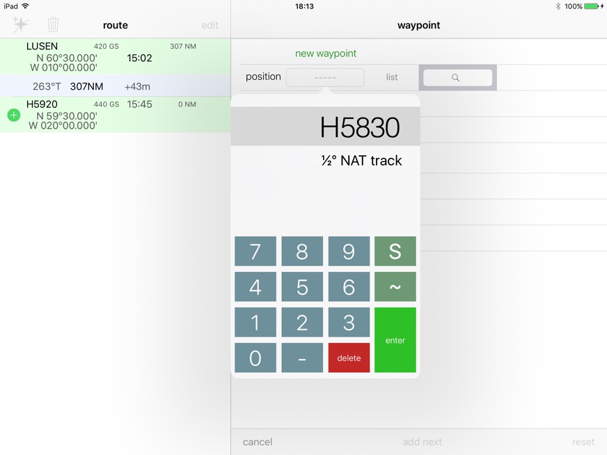
When waypoints are entered select ‘add’ or ‘add next’ to insert the waypoint into the route. The righthand screen acts like a scratchpad - a new waypoint needs to be defined then EXECuted into the route sequence. ‘add’ will only insert this one waypoint whereas ‘add next’ will add the waypoint then set the screen for the entry of the subsequent waypoint.
A Swipe Left gesture on the righthand screen when creating a new waypoint will add the waypoint to the route sequence and set the screen for the next addition.
Step 2: waypoint data
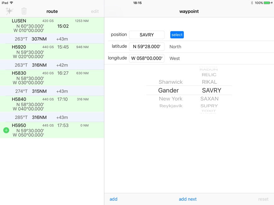
Waypoint position can be entered in four ways:
-
1.5LNC Five Letter Name Code format - in the ‘position box’ enter the position as per a FMC eg 5620N or H5630 (for half-degree waypoints)
-
2.Using the ‘list’ selector, choose a named waypoint from the FIR lists.
-
3.Search the FIR listed waypoints by typing the full waypoint name into the search box. Common North Atlantic waypoints are available.
-
4.Enter Lat/Lon coordinates in DD°MM.mmm (degrees and decimal minutes format)
Groundspeed at the waypoint, Actual arrival time and Distance to Go can be entered at the waypoint. This will generate arrival times against the waypoints.
If a DtoGo is entered for a waypoint that waypoint (and only that waypoint) becomes a reference waypoint against which all other DtoGo data is calculated for each of the other waypoints. This can be used by entering the DtoGo value from the original flight plan against a point common to a reroute and the original plan. In this way track distance to a known fuel fix can be established to provide valid fuel checks referenced to the original flight plan waypoint DtoGo .
Use the ‘reset’ button to clear ATA and DtoGo fields.
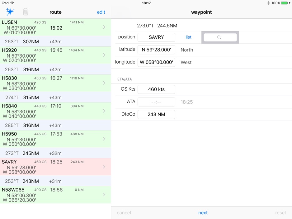
Step 3: editing the route
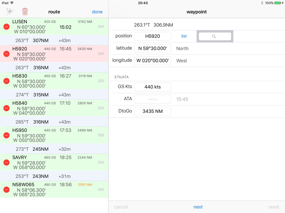
Individual waypoints can be deleted by left swiping the waypoint line. Press ‘edit’ on the lefthand screen to more comprehensively edit the route list. Waypoints can be deleted or reordered. Pressing the waste bin button gives the option of clearing the entire list.
Step 4: data presented
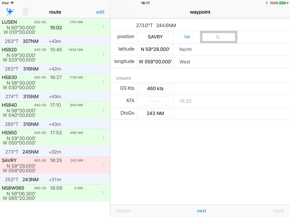
Information appearing between the waypoints on the lefthand screen represents the track, distance and, if defined by groundspeed, timing information.
DtoGo information is referenced to a defined waypoint which has its DtoGo field manually overwritten. Only one waypoint can be the DtoGo reference.
Notes: methods of calculation
All distances are defined using the WGS84 reference ellipsoid of revolution for the shape of the earth. Calculations are carried out using cartesian x,y,z coordinates in metres and converted to nautical miles for display. Typical accuracy is in the order of 10cm for legs up to 9999NM. Other methods (eg Standby Nav) that use spherical trigonometry will be in error by about 1NM over a typical 10° longitude leg length.
Tracks between waypoints (as shown on the lefthand screen) are rounded to the nearest integer value.
Distances between waypoints (as shown on the lefthand screen) are rounded to the nearest integer value based on the actual distance between the two points. These distances are not cumulative and the value after rounding is not determined by the overall running total of track distances from the end of the route.
Tracks and Distances on the righthand screen can be seen to 1 decimal place to show the effect of rounding on the left screen.
Times are running totals from the last specified ATA. Each running total at the waypoint is rounded. The leg time is the difference between the 2 rounded running totals. It is thus possible that it may produce a figure that looks to have been rounded incorrectly based on the specific distance/speed of the legbut this method eliminates cumulative rounding errors along the route.
DtoGo values are running totals referenced from the specified datum DtoGo, or the end of the route if there is none specified. Each running total at the waypoint is rounded. As this would show a distance between waypoints that is the difference between two rounded running totals rather than a single actual distance value which is individually rounded, a discrepancy may develop between any sum of the individual rounded distances and the cumulative running total of DtoGo values. For inter-waypoint distances the displayed distance is more accurate. For overall route length the DtoGo value is more accurate. This is a consequence of the rounding schema employed.
Dougie Roxburgh 2017

